UN
37 Lynton Drive
£ 198,000
Description
We don't have a Description for this property.
- Bedrooms
- 3
- Bathrooms
- 0
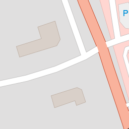

Leaflet © OpenStreetMap contributors
The heatmap indicates the level of crime in the area. The color of the heatmap indicates the crime severity and recency.
Metrics Year-on-Year
- Average area value
- 320,000.00 £Decreased by 1.71 %
- Average area rental value
- 8,975.00 £/moIncreased by 717.40 %
- Est rental Yield
- 33.66 %Increased by 731.11 %
- Crime Rate
- 27.00 %Unchanged by 0.00 %
from 325,557.00 £
from 1,098.00 £/mo
from 4.05 %
from 27.00 %
Nearby Schools
| Name | Type | Ofsted | Distance |
|---|---|---|---|
| Greenbank High School | Academy Converter | 0.39 KM | |
| Birkdale High School | Academy Converter | Good | 0.93 KM |
| Farnborough Road First Steps Children'S Centre | Children's Centre | 1.15 KM | |
| Farnborough Road Junior School | Community School | Good | 1.37 KM |
| Farnborough Road Infant School | Community School | Good | 1.37 KM |
Images
Nearby Streets
| Name | Average Price | Average Sqft | Distance |
|---|---|---|---|
| Greenbank Drive | £ 0 | 0 | 0.00 KM |
| Harrod Drive | £ 650,000 | 0 | 0.00 KM |
| Grosvenor Gardens | £ 625,000 | 0 | 0.00 KM |
| Broadlands | £ 0 | 0 | 0.00 KM |
| Belgrave Place | £ 629,999 | 0 | 0.00 KM |
Nearby Transport
| Name | NLC | TLC | Distance |
|---|---|---|---|
| Hillside | 2231 | HIL | 0.20 KM |
| Birkdale | 2352 | BDL | 1.92 KM |
| Ainsdale | 2350 | ANS | 2.82 KM |
| Southport | 2262 | SOP | 3.83 KM |
| Meols Cop | 2357 | MEC | 6.16 KM |
Nearby Listings
| Address | Price | Type | Score | Distance |
|---|---|---|---|---|
| Lynton Drive, Birkdale, Southport | £ 330,000 | BUY | 7 / 10 | 0.06 KM |
| Lynton Drive, Hillside, Southport, Merseyside, PR8 4QQ | £ 260,000 | BUY | 7 / 10 | 0.07 KM |
| Lynton Drive, Southport, Merseyside, PR8 | £ 290,000 | BUY | Unknown | 0.07 KM |
| Lynton Road, Birkdale, Southport | £ 395,000 | BUY | 7 / 10 | 0.12 KM |
| Lynton Road, Birkdale, Southport | £ 395,000 | BUY | 7 / 10 | 0.13 KM |
Nearby Properties
| Address | Price | Distance |
|---|---|---|
| 39 Lynton Drive | £ 1,100 | 0.00 KM |
| 37 Lynton Drive | £ 198,000 | 0.00 KM |
| 35 Lynton Drive | £ 235,000 | 0.00 KM |
| 8 Lynton Drive | £ 216,000 | 0.07 KM |
| 32 Lynton Drive | £ 199,950 | 0.07 KM |